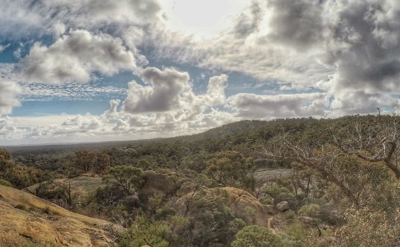
Melville Caves is approximately 20-minute drive from Inglewood and Wedderburn or 200KM from Melbourne CBD. Situated in Kooyoora State Park Melville caves attracts a lot of visitors and tourists to the unique rock formations and spectacular surrounding views.
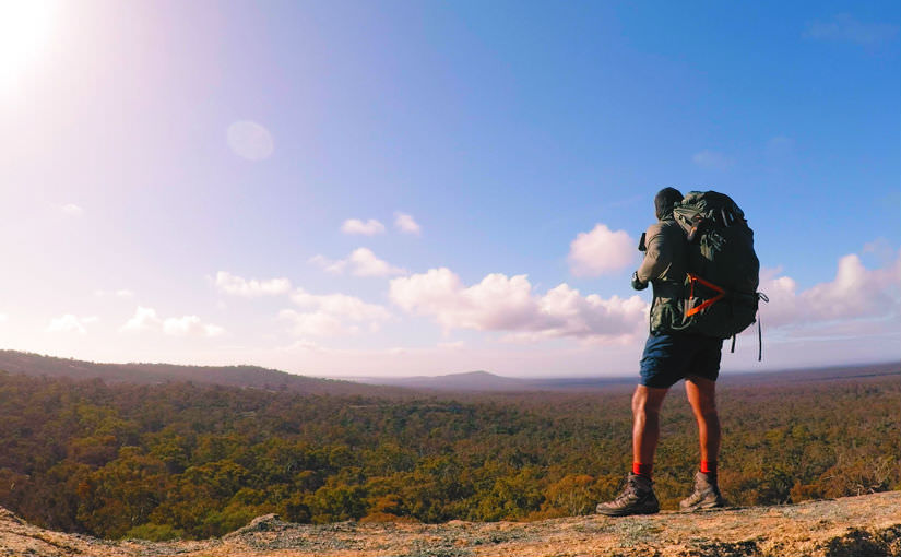
Like an addiction, yet again I purchased more hiking gear and was looking for a quick overnight walk close to Bendigo to test. A friend of mine from Melbourne decided to join the hike as preparation for his attempt at the Appalachian Trail in a few years.
The day we picked for the hike was going to be a cold winter day. Top of 8C with minimums of -2C. This would test all our gear and our survival to live. If not the car was close by and I could get back home within the hour.
There are several walks to do at Melville Caves. We decided on the Long Rock Walking Trail. This is away from the populated tourist area of Melville Caves and you can start the track straight from the overnight camping area. The picnic area was crowded with tourists, but we had the whole camping area to ourselves.
Melville Caves Hiking Trip Notes
- The entire walk is around 6.5KM. *See GPS Notes Below
- The walk will bring you back to the camping area. (Loop)
- You can also start and finish the hike from the Picnic Area
- Take a good camera, plenty of photo opportunities
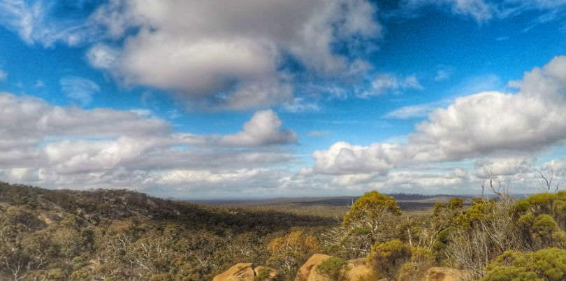
- So many lookouts and views of Kooyoora State Park
- Many sidewalks and exploring opportunities
- Good track signage, however, the trail is overgrown in some parts
- Can be extremely slippery when wet. (Walking on rocks)
- Some scrambling and narrow passages to get through
- Can be walked easily in 2 hours. (Day Walk)
- Weather can change quickly at elevation and open areas
- Full Telstra coverage available at the campsite and most sections of the walk
- Parks Victoria – Leave your drone at home. < Have you read this article?
** Side note, this hike doesn’t go past the Melville Caves Lookout. If you want to do a sidewalk to Melville Caves Lookout, you can park your car or hike from the Picnic Ground and walk a short 300M to the top.
Long Rock Walking Trail – GPS Data
You can download the GPX Data to use on your own GPS device. You might notice the GPS indicates over 9KM of walking. This is due to us stopping at every location, taking sidewalks, bushwhacking and exploring the area. We even lost the trail due to overgrown areas and backtracked a little to get back on. If you follow the signs for Long Walk Walking Track, you shouldn’t have any issue. From the picnic area look for “Southern Lookout” sign. *Always carry an updated map or GPS. Download / View GPS Data for the hike.
Melville Caves Long Rock Hiking Video
Check out the hiking video on YouTube. Please feel free to Subscribe and Share. Or you can watch it here below. Instagram user can watch it on IGTV.
Hike Summary
Overall, this is an easy hike if you just want to get away for the weekend. The area has some beautiful short walks and you can even camp out or enjoy the picnic areas. Great place to explore, see the sights and get some incredible views. I will definitely return to explore more of the area in the coming month.
Check out the gear I use on every hike. Do you have questions or gear recommendations? Get in contact with me.