After my recent failed attempt due to bad weather, I decided to take some time off work and have another go at completing the Grampians Peaks Trail. I headed off early to Halls Gap. The weather was supposed to be fine and sunny. With tops of 20 degrees and no sign of rain this was the perfect opportunity to attempt the first section of the newly opened Grampians Peaks trail. I had already submitted by trip intention form via email to the National Park and Cultural Centre – Brambuk.
The staff at Brambuk was knowledgeable and had previously given me a call to discuss the hike, safety, water and check on the bookings for Bugiga Hiker Camp. With everything set in place, I arrived at Halls Gap around 10:00am and parked the car at Borough Huts. Since my walk was going to end at Borough Huts, this was a perfect spot to park the car. My walk was going to start from Halls Gap , travel through the section one of the Grampians Peaks Trail and conclude at Borough Huts. I was going to skip the third day which was basically walking back to Halls Gap.
On arrival at Borough Huts, I had organised Halls gap Tourism Shuttle bus, run by Roy Clapp to pick me up and take me to the starting point for the walk. He provides a great service if you ever need a shuttle bus or a pick up in the Halls Gap area. Roy dropped me off on School Road near the swimming pool and after a quick check of the hiking bag and equipment I was off.
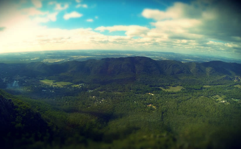
First stop was Venus Baths, packed with school kids and day visitors, I by passed this section and kept steadily moving up. With 15KG on my back, I felt every step all the way to the Pinnacles. Some great stops on the way, Grand Canyon, Cool Chamber and Silent Street. The last section leading to the Pinnacle was tough going, but slowly I made it up to the top just past 1PM.
Download Full GPS Data for Grampians Peaks Trail:
Day 1: Halls Gap to Bugiga Hiker Camp via Pinnacle
Day 2: Bugiga Hiker Camp > Mount Rosea > Borough Huts
(You can download the file via Wikiloc or the Garmin Website. I’ve combined both days into one GPX file to follow on your own device.)
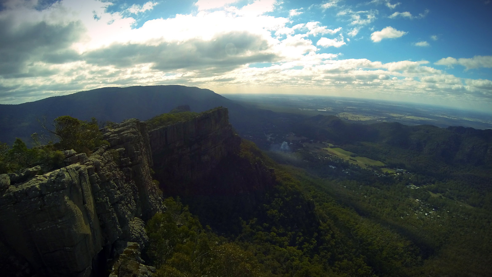
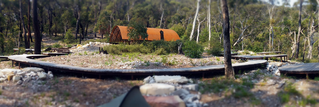
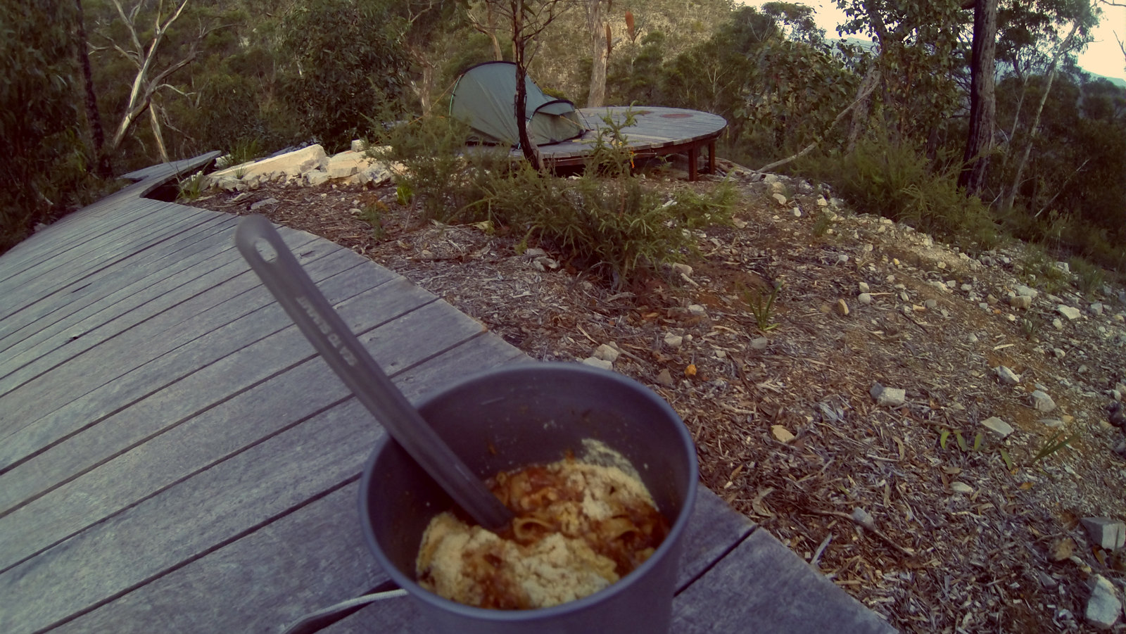
After a quick stop at the Pinnacle for some lunch, photos and some 360 video, I was off again now heading to Bugiga Hiker Camp for the overnight stay. From the Pinnacle the track surprisingly leads uphill to Sundial carpark. Some great views along the way of Mt William and Fyans Valley. Heading closer to Sundial Carpark you will come across Lakeview Lookout, which is also a great spot to stop and take a break. From here it’s pretty much smooth sailing into Bugiga. Just keep a look out for the track signs that will lead you through to Bugiga. After almost 5 hours on the trail, I arrived at Bugiga. Had the entire camp site to myself. Plenty of water in the tanks (Water needs to be treated), good toilets and a great spot to camp for the night. (Note: You need to pre-book to camp here via the Parks Website). More on Bugiga Hiker Camp from my previous stay and blog post. (November 2015).
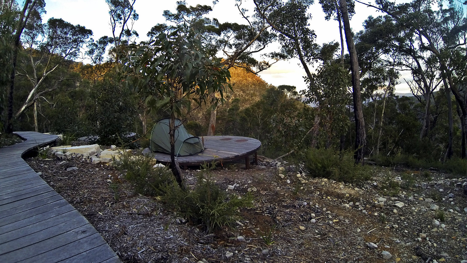
This was probably one of the best camping sites I’ve ever stayed in. Had a restful night’s sleep in the Vango Banshee tent. With a clear night, no wind, warm overnight temperature. This was one of the perfect camping experiences for me for some time. In the morning, woke up early, breakfast, packed up and started the steep climb to Mount Rosea.
This climb was tough going. I had to stop every few hundred meters to catch my breath. Not an issue as every time you stopped, there was great views as far as the eye could see. I lost count on how many pictures I took, some of them can be seen in the gallery below. The steep 2KM uphill section leading up to Mount Rosea took me almost 2 hours. I was feeling the pack weight and the steady chocolates and snacks were fuelling my uphill climb to the top. While waiting for my heart rate to drop, I took this incredible 360 picture which can be viewed on Google+ and Google Maps.
The last section leading to Mount Rosea it’s important to follow the yellow arrows. Without these lifesaving arrows, I would have never found my way to the top. The trail markings are well spaced out and provide an accurate route for your walk. I would hate to walk this section in bad weather or heavy fog. Thanks to Parks Victoria for the well maintained tracks and markings.
Note in some areas, you may need to remove the pack so you can fit through the gaps. Yes it gets a little narrow in some sections. But easy to manage the rock hopping and scrambling.
At the top of Mount Rosea it’s a great view and perfect spot to have some lunch and rest the legs from the climb. I had perfect weather. Not a cloud in sight, a gentle breeze, full 360 views and relatively warm for autumn. After exploring the area, it was time to head down to Borough Huts. This was the easy part – all downhill. Approximately 8KM of downhill walking and was a breeze to get back down. The initial downhill section over rocks from Mount Rosea was a little tricky. My one walking stick I had, finally came to good use here as the knees took a battering getting down. After the initial 1KM if scrambling downhill, it was smooth sailing all the way into Borough Huts.
Overall this was a memorable walk in the Grampians. Will be sure to return soon to take more pictures and explore the area. If you have extra time, it’s a great place to explore. I mainly stayed on the Grampians Peaks Trail path for the majority of the walk.
Additional Grampians Peaks Trail Notes:
Food: This was the first trip I used food supplied from Strive Food. These meals were delicious to say the least. Pasta Bolognese for dinner and the Mountain Muesli for breakfast. Both easy to prepare, very generous meal servings and light to carry. I highly recommend checking out the website for more meal options. Based in Tasmania.
Water: I carried around 4 litres on the first day. At Bugiga, I was lucky there was plenty of water in the tank. There was plenty of water on the trail as well due to recent rain in the area. I used the Sawyer Squeeze to treat the water.
Hiking and Gear List: Want to know what I carry in my pack? Read the full updated Hiking Gear List.
Hey, you have inspired me …. I’m booked in for 10 June !
Looking forward to it, thanks for your hints and tips.